

10-Year Anniversary of Hurricane Irene
This week is the 10-year anniversary of Hurricane Irene, which impacted many of the Caribbean Islands and several states along the eastern U.S., from South Carolina to Maine. USGS science played a vital role in helping inform preparedness and response efforts for the storm.
 Irene, which at one point was a category three hurricane, brought destructive storm surge, extreme winds, record-breaking rainfall and flooding. Many communities found themselves isolated after the storm passed, as roads and bridges were washed out. Several lives were lost and damages were in the billions of dollars.
Days before the storm made landfall in the eastern U.S., USGS scientists deployed an array of instruments along the coast to help monitor conditions such as wave height, storm tide, water levels and weather conditions. Throughout the storm, the USGS’s permanent nationwide streamgage network provided real-time water data in impacted areas. Following the storm, USGS crews deployed to gather high-water marks used to determine the extent of inundation from storm tide and inland flooding.
The Green Mountains of Vermont is one area that faced devastating impacts, as floodwaters damaged or destroyed more than 480 bridges, 960 culverts and 500 miles of state highways.
The Connecticut River at Middle Haddam, Connecticut, recorded nine feet in surge. New Hampshire and Vermont reached record levels for total precipitation in the month of August.
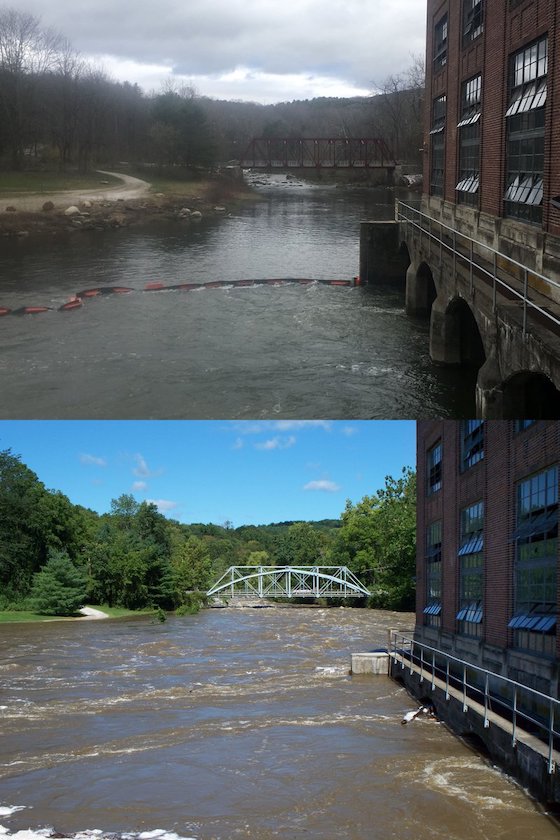
The USGS streamgage on the Pemigewasset River at Woodstock, New Hampshire, documented the highest flood stage in the 76 years of record, peaking at 16.97 feet, and the USGS streamgage on the Saxtons River in Vermont documented the highest flood stage in the 63 years of record, peaking at 19.58 feet. Other examples include the USGS streamgage at the Mad River near Moretown, Vermont, that documented the second highest flood stage in the 93 years of record, peaking at 19.26 feet, and the USGS streamgage on the Pemigewasset River at Plymouth, New Hampshire, that documented the seventh highest flood stage in the 117 years of record, peaking at 21.38 feet.
Scientists also measured sediment concentrations in several rivers, streams and coastal areas to understand the storm’s impact to water quality and surrounding ecosystems. This includes the Connecticut River, which had the highest sediment concentration ever recorded in the days after the storm.
USGS science is valuable to emergency managers, water resource managers, the public and other decision-makers before, during and after significant storms. USGS data help inform decisions such as determining when and where to evacuate, what roads to close, whether to issue a disaster declaration, what recovery efforts may be needed and planning for future development.

For example, the USGS develops and refines flood inundation maps and provides data to other agencies developing flood maps as well. Flood inundation maps identify where potential flooding could occur and the estimated severity. USGS data also help inform flood insurance research by the Federal Emergency Management Agency, and inform National Weather Service decisions on flood predictions on the severity and timing of floods as they progress.
Learn more about the role of the USGS New England Water Science Center, which is one of many centers that helped with the storm, at https://www.usgs.gov/centers/new-england-water/science/remembering-tropical-storm-irene-new-england.


